We use cookies on this site to enhance your user experience
By clicking the Accept button, you agree to us doing so. More info on our cookie policy
We use cookies on this site to enhance your user experience
By clicking the Accept button, you agree to us doing so. More info on our cookie policy

As part of the reintroduction program for the northern bald ibis, Helena accompanied the birds to their winter quarters as their foster mother. Over many weeks, she got the animals used to her, and they then followed her ultralight aircraft south. She knows each bird by name, and when they were released into the wild, she was both happy and sad.
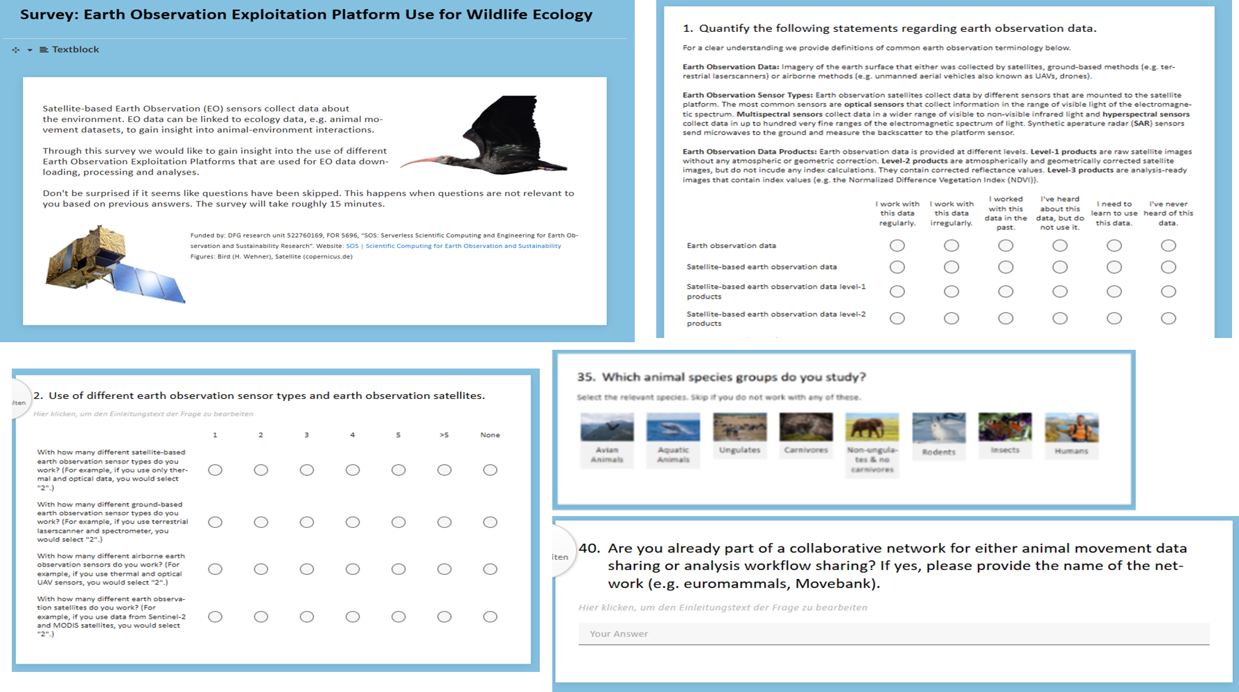
Through this survey we gained insight into the use of different earth observation exploitation platforms that are used for EO data downloading, processing and analyses. Additionally, we retrieved information about the use of different types of EO data, EO sensors used, specific satellites used and auxiliary data, e.g. weather and animal movement data.
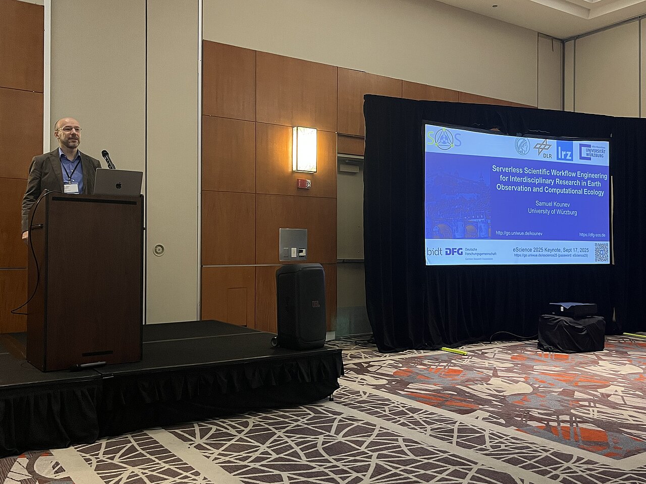
Prof. Samuel Kounev delivered a Keynote on “Serverless Scientific Workflow Engineering for Interdisciplinary Research in Earth Observation and Computational Ecology” at the 21st IEEE International Conference on eScience. Chicago, September 15-18, 2025. The slides are available online (Password: eScience25).
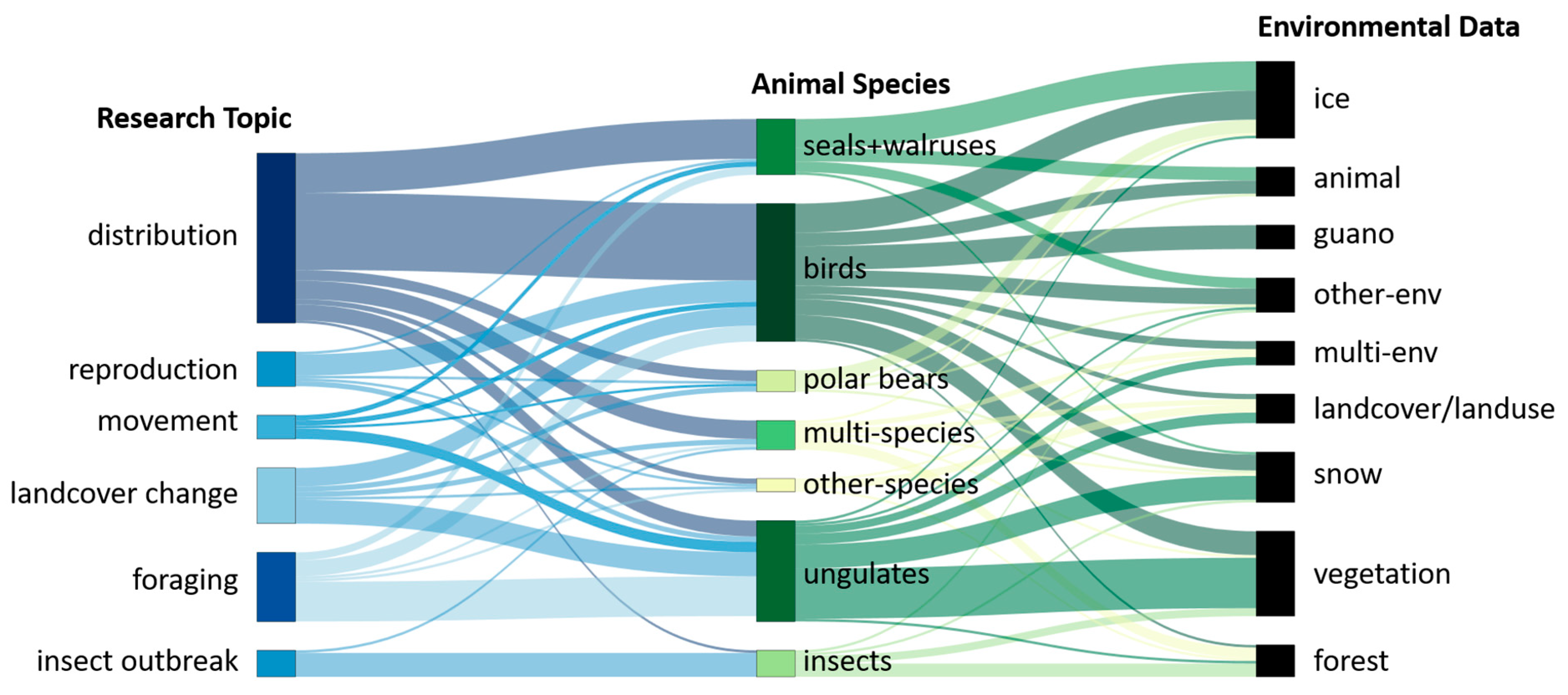
The extreme conditions of polar and mountain regions foster uniquely adapted wildlife. We reviewed 145 SCI-journal publications between 2000 and 2024 and examine how Earth observation is used in wildlife ecology research in these regions.
This survey is conducted as part of the EO1 subproject. In this subproject we work on the detection of causalities between land surface dynamics and animal movement by using satellite-based earth observation data. Through this survey we want to gain better insight in the actual use of earth observation data and earth observation exploitation platforms when connected to wildlife ecology. Thank you for your support and do not hesitate to further share the survey with your contacts.