<?xml version="1.0" encoding="utf-8"?><feed xmlns="http://www.w3.org/2005/Atom" xml:lang="en"><generator uri="https://jekyllrb.com/" version="4.4.1">Jekyll</generator><link href="https://dfg-sos.de/feed.xml" rel="self" type="application/atom+xml" /><link href="https://dfg-sos.de/" rel="alternate" type="text/html" hreflang="en" /><updated>2026-01-26T23:46:40+00:00</updated><id>https://dfg-sos.de/feed.xml</id><title type="html">SOS</title><subtitle>DFG Research Unit - Scientific Computing for Earth Observation and Sustainability (SOS)
</subtitle><entry><title type="html">First Annual Meeting at Leibniz Computing Centre</title><link href="https://dfg-sos.de/news/2026/01/20/annual-meeting-leibniz-computing-centre/" rel="alternate" type="text/html" title="First Annual Meeting at Leibniz Computing Centre" /><published>2026-01-20T00:00:00+00:00</published><updated>2026-01-20T00:00:00+00:00</updated><id>https://dfg-sos.de/news/2026/01/20/annual-meeting-leibniz-computing-centre</id><content type="html" xml:base="https://dfg-sos.de/news/2026/01/20/annual-meeting-leibniz-computing-centre/"><![CDATA[<p>For two days, our DFG Research Unit held its annual meeting hosted by the Leibniz Supercomputing Center, LRZ, in Garching near Munich. Members of the computer science chairs of the University of Wuerzburg and LRZ , colleagues of the “Land Surface Dynamics” department of DLR’s Earth Observation Center, and experts of the Max Planck Institute of Animal Behavior performed a deep-dive on their one-year research. Concepts for innovative and transferable frameworks for serverless scientific computing, including concepts and building blocks to support the extension and integration of existing platforms, were developed and discussed. Research studies on big data Earth Observation processing tailored to these platform concepts and vice versa supply the case studies. Long-time-series-based Earth Observation analyses on land surface dynamics, specifically snow cover, but also other geophysical variables, will help to explain and predict large animal swarm movement pathways, and sustainable processing architectures will enable upscaling and spatial and temporal transfer.</p>

<p>About 30 scientists - including about 8 PhD students – were joined by two high-profile invited international researchers from the University of Chicago in the USA – namely Prof’s Ian Foster and Kyle Chard. You can find more details on our DFG Research Unit, which now runs for one year and is ongoing for another three years, as well as contact details on this website.</p>

<p><img src="/img/posts/20260120_meeting_leibnizcentre.jpg" alt="Image of Team during the event" /></p>]]></content><author><name>Lorenz Gruber</name></author><category term="news" /><category term="meeting" /><summary type="html"><![CDATA[For two days, our DFG Research Unit held its annual meeting hosted by the Leibniz Supercomputing Center, LRZ, in Garching near Munich. Members of the computer science chairs of the University of Wuerzburg and LRZ , colleagues of the “Land Surface Dynamics” department of DLR’s Earth Observation Center, and experts of the Max Planck Institute of Animal Behavior performed a deep-dive on their one-year research. Concepts for innovative and transferable frameworks for serverless scientific computing, including concepts and building blocks to support the extension and integration of existing platforms, were developed and discussed. Research studies on big data Earth Observation processing tailored to these platform concepts and vice versa supply the case studies. Long-time-series-based Earth Observation analyses on land surface dynamics, specifically snow cover, but also other geophysical variables, will help to explain and predict large animal swarm movement pathways, and sustainable processing architectures will enable upscaling and spatial and temporal transfer.]]></summary><media:thumbnail xmlns:media="http://search.yahoo.com/mrss/" url="https://dfg-sos.de/img/posts/20260120_meeting_leibnizcentre.jpg" /><media:content medium="image" url="https://dfg-sos.de/img/posts/20260120_meeting_leibnizcentre.jpg" xmlns:media="http://search.yahoo.com/mrss/" /></entry><entry><title type="html">Interview: Helena Wehner at “Die Blaue Couch”</title><link href="https://dfg-sos.de/blog/2026/01/14/interview-br1-blaue-couch/" rel="alternate" type="text/html" title="Interview: Helena Wehner at “Die Blaue Couch”" /><published>2026-01-14T00:00:00+00:00</published><updated>2026-01-14T00:00:00+00:00</updated><id>https://dfg-sos.de/blog/2026/01/14/interview-br1-blaue-couch</id><content type="html" xml:base="https://dfg-sos.de/blog/2026/01/14/interview-br1-blaue-couch/"><![CDATA[<p>As part of the reintroduction program for the northern bald ibis, Helena accompanied the birds to their winter quarters as their foster mother. Over many weeks, she got the animals used to her, and they then followed her ultralight aircraft south. She knows each bird by name, and when they were released into the wild, she was both happy and sad.</p>

<p>Helena Wehner lives for one of the most unusual and at the same time most endangered bird species in Europe: the northern bald ibis. As a research assistant in the northern bald ibis team, she is involved in a unique reintroduction project in Germany, Austria, and Switzerland. On the Blue Couch, she talks about how she became a foster mother for young northern bald ibises—and why these birds have completely turned her life upside down.</p>

<p>See the whole interview in german on the <a href="https://www.ardaudiothek.de/episode/urn:ard:episode:edbb345d4fa0ff0f/">ARD Mediathek</a>.</p>

<p><img src="/img/posts/2026-01-12-helena-br1.png" alt="" /></p>]]></content><author><name>Helena Wehner</name></author><category term="blog" /><category term="interview" /><summary type="html"><![CDATA[As part of the reintroduction program for the northern bald ibis, Helena accompanied the birds to their winter quarters as their foster mother. Over many weeks, she got the animals used to her, and they then followed her ultralight aircraft south. She knows each bird by name, and when they were released into the wild, she was both happy and sad.]]></summary><media:thumbnail xmlns:media="http://search.yahoo.com/mrss/" url="https://dfg-sos.de/img/posts/2026-01-12-helena-br1.png" /><media:content medium="image" url="https://dfg-sos.de/img/posts/2026-01-12-helena-br1.png" xmlns:media="http://search.yahoo.com/mrss/" /></entry><entry><title type="html">Survey on Earth Observation Exploitation Platform Use for Wildlife Ecology</title><link href="https://dfg-sos.de/blog/2025/12/08/eo-platform-survey-helena/" rel="alternate" type="text/html" title="Survey on Earth Observation Exploitation Platform Use for Wildlife Ecology" /><published>2025-12-08T00:00:00+00:00</published><updated>2025-12-08T00:00:00+00:00</updated><id>https://dfg-sos.de/blog/2025/12/08/eo-platform-survey-helena</id><content type="html" xml:base="https://dfg-sos.de/blog/2025/12/08/eo-platform-survey-helena/"><![CDATA[<h1 id="survey-on-earth-observation-exploitation-platform-use-for-wildlife-ecology">Survey on Earth Observation Exploitation Platform Use for Wildlife Ecology</h1>

<h3 id="helena-wehner1-andreas-dietz2-claudia-kuenzer12">Helena Wehner<sup>1</sup>, Andreas Dietz<sup>2</sup>, Claudia Kuenzer<sup>1,2</sup></h3>

<ol>
  <li>
    <p><em>Department of Remote Sensing, Institute of Geography and Geology, University of Wuerzburg, 97074 Wuerzburg, Germany</em></p>
  </li>
  <li>
    <p><em>German Remote Sensing Data Center (DFD), Earth Observation Center (EOC), German Aerospace Center (DLR), 82234 Wessling, Germany</em></p>
  </li>
</ol>

<h2 id="1-introduction">1. Introduction</h2>

<p>Satellite-based Earth Observation (EO) sensors collect data about the environment. EO data can be linked to ecology, e.g. animal movement data collected by GPS tracking, to gain insight into animal-environment interactions. The number of accessible and new EO data is growing and so is the demand for information about a changing environment. Already ten years ago, several publications stated the need to better inform ecologists about EO data analysis possibilities [1], [2], [3], [4]. By conducting this survey, we want to know if that changed to a better, if the gap between EO developments and EO applied in wildlife ecology became narrower.</p>

<p>Through a survey we gained insight into the use of different earth observation exploitation platforms that are used for EO data downloading, processing and analyses. Additionally, we asked for information about the use of different types of EO data, EO sensors used, specific satellites used and auxiliary data, e.g. weather and animal movement data. At the end of the survey, we asked for more personal information about research focus and area, main animal species studied, as well as affiliations and professions. Personal questions, e.g. contact information, were explicitly stated to be not mandatory. The survey was sent around in several ecology and animal movement newsletters as well as spread forward by the colleagues of the SOS research unit working in disciplines of EO and wildlife ecology.</p>

<h2 id="2-survey-set-up">2. Survey Set-Up</h2>

<p>In total the survey contained 42 questions. We designed the survey in a way that no question was mandatory. Some conditional questions had to be answered to proceed to further questions. Because of conditional questions only with a low probability someone would be asked to answer all 42 questions. After some tests done by colleagues we estimated the general response time at roughly 15 minutes. Examples of the survey’s layout can be seen in Figure 1. A list of all questions can be seen in Figure 2 (x-axis). The whole survey and its results are free accessible at the following github repository: <a href="https://github.com/dfg-sos/Survey-on-Earth-Observation-for-Widllife-Ecology/issues">dfg-sos/Survey-on-Earth-Observation-for-Widllife-Ecology</a>.</p>

<!-- ![This image shows a survey question labeled "35. Which animal species groups do you study?" It asks the user to select relevant species groups or skip if none apply. There are eight options displayed as buttons with images and labels: 1. Avian Animals (birds) 2. Aquatic Animals (water-dwelling) 3. Ungulates (hoofed mammals) 4. Carnivores (meat-eating animals) 5. Non-ungulates & no carnivores (other mammals) 6. Rodents 7. Insects 8. Humans Each option has a representative photo above its label. The interface is clean, with a blue border around the question and options.](/img/posts/2025-12-08-eo-platform-survey-helena/image_001.png) -->

<p><img src="/img/posts/2025-12-08-eo-platform-survey-helena/image_003.png" alt="This image shows the introduction page of a survey titled **&quot;Survey: Earth Observation Exploitation Platform Use for Wildlife Ecology&quot;**. The background is light blue, and the main content is inside a white box. The text explains that satellite-based Earth Observation (EO) sensors collect environmental data, which can be linked to ecology data (like animal movement datasets) to study animal-environment interactions. The survey aims to gather insights into the use of different EO Exploitation Platforms for downloading, processing, and analyzing EO data. It mentions that some questions may be skipped based on previous answers and that the survey takes about 15 minutes. There are two images: one of a satellite in the bottom left corner and one of a bird (possibly an ibis) in the top right corner. At the bottom, there is a funding acknowledgment and references to the research unit and related websites." /></p>

<p><img src="/img/posts/2025-12-08-eo-platform-survey-helena/image_005.png" alt="This image shows a survey form titled **&quot;Quantify the following statements regarding earth observation data.&quot;** The form provides definitions for key terms related to earth observation data, sensor types, and data products (level-1, level-2, level-3). Below the definitions, there is a table with rows listing different types of earth observation data (e.g., satellite-based, airborne, optical, multispectral, SAR, thermal, hyperspectral). Each row has a set of radio buttons for respondents to indicate their familiarity or experience with each data type. The options are: - I work with this data regularly. - I work with this data irregularly. - I worked with this data in the past. - I've heard about this data, but do not use it. - I need to learn to use this data. - I've never heard of this data. The form is designed to assess the respondent's experience and knowledge of various earth observation data types." /></p>

<p><img src="/img/posts/2025-12-08-eo-platform-survey-helena/image_004.png" alt="This image shows a survey question about the use of different earth observation sensor types and satellites. The question is titled &quot;2. Use of different earth observation sensor types and earth observation satellites.&quot; There are four sub-questions, each asking how many different types of sensors or satellites the respondent works with: 1. Satellite-based earth observation sensor types 2. Ground-based earth observation sensor types 3. Airborne earth observation sensors 4. Earth observation satellites For each sub-question, there is a row of radio buttons labeled 1, 2, 3, 4, 5, &gt;5, and None, allowing the respondent to select the appropriate number. Each sub-question provides an example to clarify what is meant by different types or satellites. The layout is clean, with a blue border around the survey section." /></p>

<p><img src="/img/posts/2025-12-08-eo-platform-survey-helena/image_002.png" alt="This image shows a section of an online survey or questionnaire. The question is labeled as number 40 and asks: **&quot;Are you already part of a collaborative network for either animal movement data sharing or analysis workflow sharing? If yes, please provide the name of the network (e.g. euromammals, Movebank).&quot;** Below the question, there is a prompt in German: *Hier klicken, um den Einleitungstext der Frage zu bearbeiten* (&quot;Click here to edit the introductory text of the question&quot;) Underneath, there is a text box labeled &quot;Your Answer&quot; where respondents can type their response. The interface has a light blue border and background." /></p>

<p><em>Figure 1. Examples of different questions of the survey.</em></p>

<p>Questions where split in the following six groups:</p>

<ol>
  <li><strong>General Earth Observation, Movement Data and Additional Data Use</strong></li>
  <li><strong>Earth Observation Exploitation Platforms</strong></li>
  <li><strong>Movement Data Access and Processing</strong></li>
  <li><strong>Information to your Study Area, Spatial and Temporal Resolution</strong></li>
  <li><strong>Personal Information and Research Focus</strong></li>
  <li><strong>Outlook</strong></li>
</ol>

<h2 id="3-survey-participation">3. Survey Participation</h2>

<p>In total 233 (mean = 78) persons had a look at the survey, 108 (46.35%, mean = 46) did answer at the maximum. Not every question was answered by each participant, mainly because of the mentioned conditional question set-up. Figure 2 displays the number of respondents for each question beginning by the first question on the left part of the x-axis and the last question on the right part of the x-axis. Starting from question number 8 (When did you begin using the following earth observation exploitation platforms?) the number of respondents gets less. When being asked for the specific earth observation exploitation platform used, is when most of the dropouts stopped the survey. From question number 10 to question number 25 the number of responses varies the most. This part of the survey varies a lot because the survey participants only get to see the questions related to the amount of earth observation exploitation platforms they marked as “known” in question number 7.</p>

<p><img src="/img/posts/2025-12-08-eo-platform-survey-helena/image_011.png" alt="" /></p>

<p><em>Figure 2. Response statistic of the survey. The number of actual responses for each question (red), number of participants who did read the question (black) and who only read and did not answer (blue).</em></p>

<p>Two questions about movement data access and movement data processing were not answered at all even when 68 participants stated in question number 4 to generally work with movement data. The last 15 questions about information on study area, spatial and temporal resolution, personal information and research focus and outlook were answered by a descending number of respondents. Compared to a start of 108 persons the survey was answered completely to the end by 95 persons (87,96%).</p>

<h2 id="4-main-takeaways">4. Main Takeaways</h2>

<p>Hereafter we show main results of all questions and survey responses by the groups described in the survey set-up above.</p>

<h3 id="41-general-earth-observation-movement-data-and-additional-data-use">4.1. General Earth Observation, Movement Data and Additional Data Use</h3>

<p>More than half of all participants do work with earth observation data and satellite-based earth observation data, specifically. Satellite-based earth observation data can be split into level-1 products (raw sensor data), level-2 (top of atmosphere and location corrected data) and level-3 products (analysis ready data, e.g. precalculated indices). Level-1 products are used by less than 10% of all participants, level-2 products by more than 30% and level-3, analysis-ready products are used the most, by more than 40% of all participants. When comparing between satellite-based sensor types most of the participants work with multispectral and optical data. Only a minor part of all participants stated to work with SAR (synthetic aperture radar), thermal and hyperspectral earth observation data. Airborne earth observation data is used by roughly 20%, less work with ground-based earth observation data, e.g. terrestrial laser scanners.</p>

<p>When respondents do not work with a specific type of earth observation data they still know about the dataset. The less participants stated they work with the data the more they stated they have heard about this data, but do not use it. Regarding the amount of different earth observation sensor types that are used, mostly people seem to work with at least two different sensors. This means not only optical data, but also SAR data is at least sometimes used.</p>

<p>We also asked for the use and knowledge about specific earth observation satellites. Sentinel-2, Landsat and MODIS each are used by more than 60% of all respondents. Very-high earth observation satellites are not used that often. High costs for getting access to this data, whereas Sentinel, Landsat and MODIS are free accessible, are probably the reason.</p>

<p>Additionally, to earth observation data 80% do work with movement data (animal and/or human), closely followed by climate/weather data and digital elevation models. Respondents do not work that often with camera traps (48%) and animals as sensors (e.g. for salinity measurements) (26%). The big number of respondents working with movement data is related to the scientific field we were aiming to reach with this survey and might be slightly biased, because we took advantage of colleague’s networks, e.g. international biologging society, to spread the survey.</p>

<p>Regarding methods of operation used for analysis nearly all participants use programming languages (84%) and GIS software (75%). Web-based user-interfaces like MoveApps and WebODM are not used that often (27%). This is possibly related to most of the participants working in science. We could not reach that many people working in municipals, national parks or conservation agencies.</p>

<h3 id="42-earth-observation-exploitation-platforms">4.2. Earth Observation Exploitation Platforms</h3>

<p>We listed 15 earth observation platforms known by the colleagues in ecology and earth observation of our research unit. To miss not any important earth observation exploitation platform that is used, but not known by our research unit, participants could write down another platform in an additional box called “Other”. That was only done by four participants. Therefore we believe we already had a good overview on earth observation exploitation platforms people are possibly working with.</p>

<p>Nearly known by every participant and 55% working with that platform, is Google Earth Engine, followed by Copernicus Browser, NASA Earthdata, USGS Earthexplorer and Sentinel Hub. On sixth position and offered in addition to the movement data platform Movebank is the Movebank EnvData environmental data annotation system.</p>

<p>Amazone and Microsoft, some of the worldwide biggest technical companies do also offer earth observation exploitation platforms. Despite their well-known companies, less than 10% of the participants work with Amazone Web Services and Microsoft Azure. Only roughly 30% know that those platforms exist.</p>

<p>Nationally platforms from our research unit partner at the German Aerospace Center (DLR) and Leibnitz Supercomputing Center, Terrabyte and EOC Geoservice (only DLR) are known my most of the participants, but only used by two, respectively none.</p>

<p>Figure 3 displays the use of the different earth observation exploitation platforms. Mostly platforms are used for data download, especially Copernicus Browser, NASA Earthdata and USGS Earthexplorer. Google Earth Engine (GEE) is used in the same amount for data processing, less for plots and map making. MoveApps is also mostly used for data processing. Figure 4 displays the ways of learning to use the different earth observation exploitation platforms. Mostly participants learnt how to use a platform by themself, only minor by online tutorials, university courses and internships. GEE, Movebank EnvData and Copernicus Browser are the only platforms a small number of participants learned about during a conference.</p>

<p><img src="/img/posts/2025-12-08-eo-platform-survey-helena/image_012.png" alt="" /></p>

<p><em>Figure 3. Use of different earth observation exploitation platforms.</em></p>

<p><img src="/img/posts/2025-12-08-eo-platform-survey-helena/image_013.png" alt="" /></p>

<p><em>Figure 4. Ways of learning to use different earth observation exploitation platforms.</em></p>

<p>At the end of the survey, we asked for more general information. We summarize that information shortly in the following abstracts.</p>

<h3 id="43-information-to-your-study-area-temporal-and-spatial-resolution">4.3. Information to your Study Area, Temporal and Spatial Resolution</h3>

<p>Most (25%) work on a national level regarding the size of the main focus area. There is no clear signal which temporal resolution is needed the most. Daily data was claimed to be important to most of the participants, but closely followed by weekly and monthly and seasonal and yearly. High spatial resolutions seem to be more important than coarse resolutions of greater than 250m. More than 70% of the participants state resolutions between 10m-30m to be important and more than 60% very high-resolution data of less than 10m.</p>

<h3 id="44-personal-information-and-research-focus">4.4. Personal Information and Research Focus</h3>

<p>Nearly 80% of all participants work at universities or research institutes. Conservation organizations, governmental organizations, national parks or even private persons are clearly underrepresented. That is visible the same way in stated professions. Roughly 60% of all participants work in post-doctoral research positions. PhD students, undergraduates, students, conservation project leaders, entrepreneurs or politicians are clearly underrepresented in this survey.</p>

<p>Regarding animal species, avian animals are dominant (29%), followed by ungulates (20%) and carnivores (14%). Rodents (7%) and aquatic animals (4%) are clearly underrepresented.</p>

<h2 id="5-conclusions-and-needs-in-science">5. Conclusions and Needs in Science</h2>

<p>Google Earth Engine, the platform most used, is capable of providing access to data that is needed often by ecologists working with earth observation data. MODIS, Landsat and Sentinel data can be downloaded from this platform. Very-high resolution (VHR) that is still required a lot, is more difficult to access. Still, using VHR data, when it is needed, people seem to have funding difficulties. Ten years ago [1], [3], [4] a need for better communication and scientific exchange in methods between earth observation scientists and wildlife ecologists was already stated. Nowadays, scientists seem to be better informed and earth observation data is widely used in wildlife ecology, but rapid developments in methods, staying up-to-date about new sensors and data availability seems to still cause difficulties, even when somebody working in ecology has a profound background in earth observation science. Artificial intelligence (AI) methods are used for object detection, animal identification, coding in general and especially debugging. The values of those new methods are seen and used, but seem to be often limited by computation power and again, a lack of funding for a stronger IT infrastructure</p>

<p>All this is mostly stated by people working in science. Much less is known about hands-on conservation work, governmental organizations and NGOs. Especially those, often lack funding for scientific work, because funding barely covers basic conservation implementations and basic needs. Scientific monitoring and analysis have to be covered by volunteers, internships or undergraduate students with limited data access. But, especially in organizations where people to work hands-on there is profound expert knowledge and data sources precisely collected across many years (pers. com.). We therefore support the idea of data-driven approaches as stated by Demsar et al. 2025 [5]. AI combined with big data sources collected across many years by conservationists and multi-sensor and multi-parameter earth observation data could reveal unseen coherences and developments by a data-driven research approach.</p>

<p>We conclude communication and scientific exchange between earth observation and wildlife ecology scientists still needs promotion. Even many scientists know about coding, platforms should offer possibilities of data access and processing without coding knowledge to support non-scientific users and promote earth observation data use in non-scientific ecology related working environments like conservation areas and municipals. Analysis workflows, processing tools, developments of new methods should be reusable and easily accessible between disciplines. Information should be more regularly exchanged not only in between widely used ecology networks, e.g. Movebank and euromammals, but between those networks and earth observation scientists. Already existing workshops, e.g. Animove Summer School, should be made accessible not only for scientists, but also for people working in conservation action, at regional environmental organizations or municipals to not only promote exchange between discipline, but also between science and application work.</p>

<p>Funded by: DFG research unit 522760169, FOR 5696, “SOS: Serverless Scientific Computing and Engineering for Earth Observation and Sustainability Research”.</p>

<h2 id="references">References</h2>

<p>[1] N. Pettorelli <em>et al.</em>, “Satellite remote sensing of ecosystem functions: opportunities, challenges and way forward,” <em>Remote Sens. Ecol. Conserv.</em>, vol. 4, no. 2, pp. 71–93, 2018, doi: 10.1002/rse2.59.</p>

<p>[2] I. Palumbo, R. A. Rose, R. M. K. Headley, J. Nackoney, A. Vodacek, and M. Wegmann, “Building capacity in remote sensing for conservation: present and future challenges,” <em>Remote Sens. Ecol. Conserv.</em>, vol. 3, no. 1, pp. 21–29, 2017, doi: 10.1002/rse2.31.</p>

<p>[3] C. Kuenzer <em>et al.</em>, “Earth observation satellite sensors for biodiversity monitoring: potentials and bottlenecks,” <em>Int. J. Remote Sens.</em>, vol. 35, no. 18, pp. 6599–6647, Sept. 2014, doi: 10.1080/01431161.2014.964349.</p>

<p>[4] N. Pettorelli, W. F. Laurance, T. G. O’Brien, M. Wegmann, H. Nagendra, and W. Turner, “Satellite remote sensing for applied ecologists: opportunities and challenges,” <em>J. Appl. Ecol.</em>, vol. 51, no. 4, pp. 839–848, 2014, doi: 10.1111/1365-2664.12261.</p>

<p>[5] U. Demšar, B. Zein, and J. A. Long, “A new data-driven paradigm for the study of avian migratory navigation,” <em>Mov. Ecol.</em>, vol. 13, no. 1, p. 16, Mar. 2025, doi: 10.1186/s40462-025-00543-8.</p>]]></content><author><name>Helena Wehner</name></author><category term="blog" /><category term="publication" /><summary type="html"><![CDATA[Survey on Earth Observation Exploitation Platform Use for Wildlife Ecology]]></summary><media:thumbnail xmlns:media="http://search.yahoo.com/mrss/" url="https://dfg-sos.de/img/posts/2025-12-08-eo-platform-survey-helena/teaser.png" /><media:content medium="image" url="https://dfg-sos.de/img/posts/2025-12-08-eo-platform-survey-helena/teaser.png" xmlns:media="http://search.yahoo.com/mrss/" /></entry><entry><title type="html">SOS Work Meeting at Earth Observation Center</title><link href="https://dfg-sos.de/news/2025/09/18/meeting-observation-center/" rel="alternate" type="text/html" title="SOS Work Meeting at Earth Observation Center" /><published>2025-09-18T00:00:00+00:00</published><updated>2025-09-18T00:00:00+00:00</updated><id>https://dfg-sos.de/news/2025/09/18/meeting-observation-center</id><content type="html" xml:base="https://dfg-sos.de/news/2025/09/18/meeting-observation-center/"><![CDATA[<p>The growing SOS team met for a two-day work meeting on September 18 and  19 in person at the DLR Earth Observation Center in Oberpfaffenhofen.  Productive discussions created take-home messages for all participants  and helped set priorities for the next steps while clarifying interfaces for subproject interactions.</p>

<p><img src="/img/posts/2025-08-19-meetingobservationcenter.jpeg" alt="Image of Team during the Meeting at Earth Observation Center" /></p>]]></content><author><name>Lorenz Gruber</name></author><category term="news" /><category term="meeting" /><summary type="html"><![CDATA[The growing SOS team met for a two-day work meeting on September 18 and 19 in person at the DLR Earth Observation Center in Oberpfaffenhofen. Productive discussions created take-home messages for all participants and helped set priorities for the next steps while clarifying interfaces for subproject interactions.]]></summary><media:thumbnail xmlns:media="http://search.yahoo.com/mrss/" url="https://dfg-sos.de/img/posts/2025-08-19-meetingobservationcenter.jpeg" /><media:content medium="image" url="https://dfg-sos.de/img/posts/2025-08-19-meetingobservationcenter.jpeg" xmlns:media="http://search.yahoo.com/mrss/" /></entry><entry><title type="html">Keynote Talk by Prof. Samuel Kounev at IEEE eScience 2025 on September 17th, 2025</title><link href="https://dfg-sos.de/blog/2025/09/17/keynote-talk/" rel="alternate" type="text/html" title="Keynote Talk by Prof. Samuel Kounev at IEEE eScience 2025 on September 17th, 2025" /><published>2025-09-17T00:00:00+00:00</published><updated>2025-09-17T00:00:00+00:00</updated><id>https://dfg-sos.de/blog/2025/09/17/keynote-talk</id><content type="html" xml:base="https://dfg-sos.de/blog/2025/09/17/keynote-talk/"><![CDATA[<p>Prof. Samuel Kounev delivered a Keynote on “Serverless Scientific  Workflow Engineering for Interdisciplinary Research in Earth Observation and Computational Ecology” at the 21st IEEE International Conference on eScience. Chicago, September 15-18, 2025. The <a href="https://go.uniwue.de/escience25">slides</a> are available online (Password: <code class="language-plaintext highlighter-rouge">eScience25</code>).</p>

<p><img src="/img/posts/2025-08-17-keynote-talk.jpg" alt="Keynote Talk by Prof. Samuel Kounev at IEEE eScience 2025" /></p>]]></content><author><name>Lorenz Gruber</name></author><category term="blog" /><category term="meeting" /><summary type="html"><![CDATA[Prof. Samuel Kounev delivered a Keynote on “Serverless Scientific Workflow Engineering for Interdisciplinary Research in Earth Observation and Computational Ecology” at the 21st IEEE International Conference on eScience. Chicago, September 15-18, 2025. The slides are available online (Password: eScience25).]]></summary><media:thumbnail xmlns:media="http://search.yahoo.com/mrss/" url="https://dfg-sos.de/img/posts/2025-08-17-keynote-talk.jpg" /><media:content medium="image" url="https://dfg-sos.de/img/posts/2025-08-17-keynote-talk.jpg" xmlns:media="http://search.yahoo.com/mrss/" /></entry><entry><title type="html">Wildlife Ecology Research in Terrestrial Polar and Mountain Regions - A Systematic Review of Satellite-Based Earth Observation Applications</title><link href="https://dfg-sos.de/blog/2025/08/11/SLR-EO4WildlifeEcologyPolar/" rel="alternate" type="text/html" title="Wildlife Ecology Research in Terrestrial Polar and Mountain Regions - A Systematic Review of Satellite-Based Earth Observation Applications" /><published>2025-08-11T00:00:00+00:00</published><updated>2025-08-11T00:00:00+00:00</updated><id>https://dfg-sos.de/blog/2025/08/11/SLR-EO4WildlifeEcologyPolar</id><content type="html" xml:base="https://dfg-sos.de/blog/2025/08/11/SLR-EO4WildlifeEcologyPolar/"><![CDATA[<p>The extreme conditions of polar and mountain regions foster uniquely adapted wildlife.
We reviewed 145 SCI-journal publications between 2000 and 2024 and examine how Earth observation is used in wildlife ecology research in these regions.</p>

<p>Read our detailed insights here: <a href="https://doi.org/10.3390/rs17162780">DOI</a></p>

<p><img src="/img/posts/2025-08-11-eo1-slr-wildlifePolarEO.png" alt="" /></p>]]></content><author><name>Helena Wehner</name></author><category term="blog" /><category term="publication" /><summary type="html"><![CDATA[The extreme conditions of polar and mountain regions foster uniquely adapted wildlife. We reviewed 145 SCI-journal publications between 2000 and 2024 and examine how Earth observation is used in wildlife ecology research in these regions.]]></summary><media:thumbnail xmlns:media="http://search.yahoo.com/mrss/" url="https://dfg-sos.de/img/posts/2025-08-11-eo1-slr-wildlifePolarEO.png" /><media:content medium="image" url="https://dfg-sos.de/img/posts/2025-08-11-eo1-slr-wildlifePolarEO.png" xmlns:media="http://search.yahoo.com/mrss/" /></entry><entry><title type="html">Participate in our Survey: Earth Observation Data and Exploitation Platforms for Wildlife Ecology</title><link href="https://dfg-sos.de/blog/2025/05/12/survey-eo-platforms-for-wildlife-ecology/" rel="alternate" type="text/html" title="Participate in our Survey: Earth Observation Data and Exploitation Platforms for Wildlife Ecology" /><published>2025-05-12T00:00:00+00:00</published><updated>2025-05-12T00:00:00+00:00</updated><id>https://dfg-sos.de/blog/2025/05/12/survey-eo-platforms-for-wildlife-ecology</id><content type="html" xml:base="https://dfg-sos.de/blog/2025/05/12/survey-eo-platforms-for-wildlife-ecology/"><![CDATA[<p>This survey is conducted as part of the <a href="/research/eo1">EO1</a> subproject. In this subproject we work on the detection of causalities between land surface dynamics and animal movement by using satellite-based earth observation data. Through this survey we want to gain better insight in the actual use of earth observation data and earth observation exploitation platforms when connected to wildlife ecology. Thank you for your support and do not hesitate to further share the survey with your contacts.</p>

<p>Link to Survey: <a href="https://survey.lamapoll.de/EarthObservation_in_Ecology">https://survey.lamapoll.de/EarthObservation_in_Ecology</a></p>

<p><img src="/img/posts/2025-05-05_eo1_survey.png" alt="" /></p>]]></content><author><name>Helena Wehner</name></author><category term="blog" /><category term="survey" /><summary type="html"><![CDATA[This survey is conducted as part of the EO1 subproject. In this subproject we work on the detection of causalities between land surface dynamics and animal movement by using satellite-based earth observation data. Through this survey we want to gain better insight in the actual use of earth observation data and earth observation exploitation platforms when connected to wildlife ecology. Thank you for your support and do not hesitate to further share the survey with your contacts.]]></summary><media:thumbnail xmlns:media="http://search.yahoo.com/mrss/" url="https://dfg-sos.de/img/posts/2025-05-05_eo1_survey.png" /><media:content medium="image" url="https://dfg-sos.de/img/posts/2025-05-05_eo1_survey.png" xmlns:media="http://search.yahoo.com/mrss/" /></entry><entry><title type="html">Interview: Nikolas Herbst about ROOT and the terrabyte platform</title><link href="https://dfg-sos.de/blog/2025/05/05/interview-terrabyte-herbst/" rel="alternate" type="text/html" title="Interview: Nikolas Herbst about ROOT and the terrabyte platform" /><published>2025-05-05T00:00:00+00:00</published><updated>2025-05-05T00:00:00+00:00</updated><id>https://dfg-sos.de/blog/2025/05/05/interview-terrabyte-herbst</id><content type="html" xml:base="https://dfg-sos.de/blog/2025/05/05/interview-terrabyte-herbst/"><![CDATA[<p>Our team member <a href="https://se.informatik.uni-wuerzburg.de/software-engineering-group/staff/nikolas-herbst/">Nikolas Herbst</a> was interviewed by the LRZ about the <a href="https://se.informatik.uni-wuerzburg.de/root/">ROOT Project</a> and the deployment on the <em>terrabyte</em> platform by DLR/LRZ.
See the whole interview about the application of the <em>terrabyte</em> HPDA system to monitor the Bavarian forest on the <a href="https://www.lrz.de/en/news/detail/terrabyte-research-based-on-satellite-data">LRZ News Page</a>.</p>

<p><img src="/img/posts/2025-05-05_root_teaser.png" alt="" /></p>]]></content><author><name>Nikolas Herbst</name></author><category term="blog" /><category term="interview" /><summary type="html"><![CDATA[Our team member Nikolas Herbst was interviewed by the LRZ about the ROOT Project and the deployment on the terrabyte platform by DLR/LRZ. See the whole interview about the application of the terrabyte HPDA system to monitor the Bavarian forest on the LRZ News Page.]]></summary><media:thumbnail xmlns:media="http://search.yahoo.com/mrss/" url="https://dfg-sos.de/img/posts/2025-05-05_root_teaser.png" /><media:content medium="image" url="https://dfg-sos.de/img/posts/2025-05-05_root_teaser.png" xmlns:media="http://search.yahoo.com/mrss/" /></entry><entry><title type="html">Automated crevasse mapping for Alpine glaciers</title><link href="https://dfg-sos.de/blog/2025/04/01/Automated-crevasse-mapping-for-Alpine-glaciers/" rel="alternate" type="text/html" title="Automated crevasse mapping for Alpine glaciers" /><published>2025-04-01T00:00:00+00:00</published><updated>2025-04-01T00:00:00+00:00</updated><id>https://dfg-sos.de/blog/2025/04/01/Automated-crevasse-mapping-for-Alpine-glaciers</id><content type="html" xml:base="https://dfg-sos.de/blog/2025/04/01/Automated-crevasse-mapping-for-Alpine-glaciers/"><![CDATA[<p>How can we automatically map glacier crevasses? Our new manuscript explores how Alpine crevasses can be mapped from high-resolution data.</p>

<p>For the first time, we provide new crevasse datasets for Ötztal, Stubai, Großglockner, Ortler and Piz Palü that can be integrated into hiking maps and glacier models.</p>

<p>This study wouldn’t have been possible without the incredible support of <a href="https://www.linkedin.com/company/deutscheralpenverein/">Deutscher Alpenverein e.V.</a> and <a href="https://www.linkedin.com/company/alpenverein-at/">Österreichischer Alpenverein</a>.</p>

<p>Read the full story here: <a href="https://www.sciencedirect.com/science/article/pii/S1569843225001426">https://lnkd.in/dv8rsQz7</a></p>

<p><img src="/img/posts/2025-04-01-alpine-glaciers.jpg" alt="" /></p>]]></content><author><name>Celia Baumhoer</name></author><category term="blog" /><category term="publication" /><summary type="html"><![CDATA[How can we automatically map glacier crevasses? Our new manuscript explores how Alpine crevasses can be mapped from high-resolution data.]]></summary><media:thumbnail xmlns:media="http://search.yahoo.com/mrss/" url="https://dfg-sos.de/img/posts/2025-04-01-alpine-glaciers.jpg" /><media:content medium="image" url="https://dfg-sos.de/img/posts/2025-04-01-alpine-glaciers.jpg" xmlns:media="http://search.yahoo.com/mrss/" /></entry><entry><title type="html">Exciting Kick-Off of the SOS Project at Dizzying Heights</title><link href="https://dfg-sos.de/news/2025/01/13/kickoff/" rel="alternate" type="text/html" title="Exciting Kick-Off of the SOS Project at Dizzying Heights" /><published>2025-01-13T00:00:00+00:00</published><updated>2025-01-13T00:00:00+00:00</updated><id>https://dfg-sos.de/news/2025/01/13/kickoff</id><content type="html" xml:base="https://dfg-sos.de/news/2025/01/13/kickoff/"><![CDATA[<p>Last week, our team had the privilege of hosting the kick-off meeting for our new DFG-funded research project Serverless Scientific Computing and Engineering for Earth Observation and Sustainability Research (SOS) at the stunning Umweltforschungsstation Schneefernerhaus, nestled at the flank of the iconic Zugspitze.</p>

<p><img src="/img/posts/20251301_kickoff_schneefernerhaus.jpg" alt="Image of Team during the kickoff event" /></p>

<p>
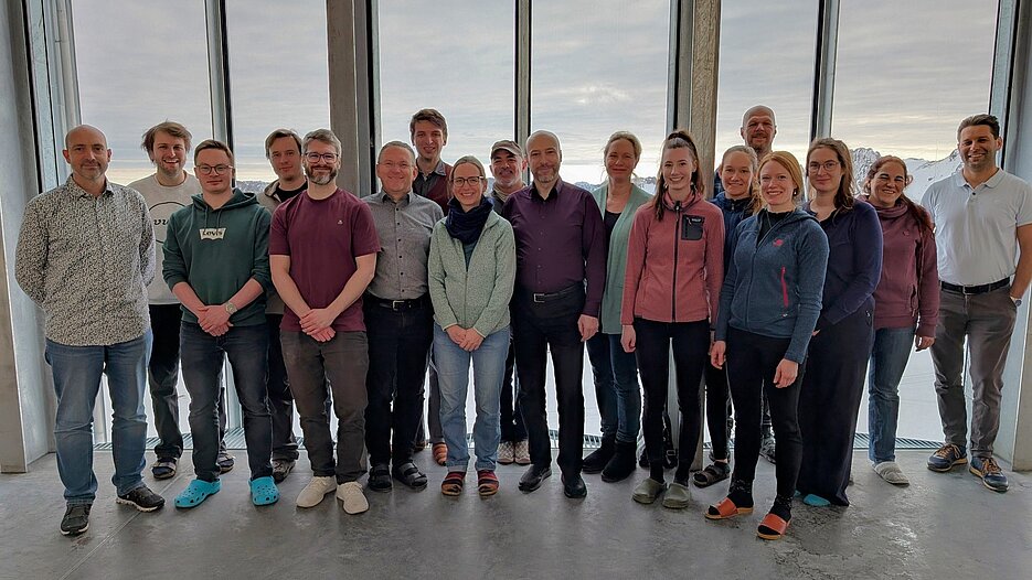
The interdisciplinary project, lead by Samuel Kounev and Claudia Kuenzer, unites 20 researchers in geography, ecology, and computer science from Deutsches Zentrum für Luft-und Raumfahrt e.V., Max Planck Institute, Leibniz Supercomputing Centre and the Julius-Maximilians-Universität Würzburg to investigate current research inquiries in land cover dynamics and biodiversity:</p>

<ul>
  <li>Causalities between land surface dynamics and animal movements</li>
  <li>Impact of climate change on global snow cover</li>
  <li>Predict changes in biodiversity by combining Earth Observation (EO) products with animal movement data.</li>
</ul>

<p>Furthermore we aim to lower entry barriers for geoscientist in general, developing and executing high-volume EO workflows with possibly heterogenous data sources, by providing a framework for serverless scientific computing and component-based workflow engineering. Ultimately, we want to enable sharing, reuse and composition of EO workflows while relieving domain-experts of laborious workflow deployment and resource provisioning.</p>

<p>We are really looking forward to this interdisciplinary project  :)
Stay tuned for the first results…</p>]]></content><author><name>Stefan Geißler</name></author><category term="news" /><category term="meeting" /><summary type="html"><![CDATA[Last week, our team had the privilege of hosting the kick-off meeting for our new DFG-funded research project Serverless Scientific Computing and Engineering for Earth Observation and Sustainability Research (SOS) at the stunning Umweltforschungsstation Schneefernerhaus, nestled at the flank of the iconic Zugspitze.]]></summary><media:thumbnail xmlns:media="http://search.yahoo.com/mrss/" url="https://dfg-sos.de/img/posts/20251301_kickoff_schneefernerhaus.jpg" /><media:content medium="image" url="https://dfg-sos.de/img/posts/20251301_kickoff_schneefernerhaus.jpg" xmlns:media="http://search.yahoo.com/mrss/" /></entry></feed>